Showing posts with label Mott Sanctuary. Show all posts

Saturday, November 14, 2020

Mott Sanctuary - Jacob Erkenbeck

The History of Berrien and Van Buren Counties 1880 has the biography of Jacob and his wife.  "As one of the early settlers of this portion of Van Buren County, he is entitled to honorable mention. He was a native of the State of New York, and was born March 18, 1801. Dec. 19, 1824, he was married to Helen Cole, who survives him. Mr. and Mrs. Erkenbeck were the parents of eight children, as follows: Cornelius, born Oct. 18, 1825; Maria, born June 25, 1827, died Aug. 22, 1866; Eleanor, born Nov. 17, 1829; Catharine, born Nov. 25, 1831; Wilham, born Feb. 10, 1834; Nicholas, born Feb. 25, 1836, died May 23, 1866; Martin, born Sept. 14, 1838; John, born June 1, 1845. In the fall of 1846, Mr. Erkenbeck removed to Michigan with his family, and settled on the farm now occupied by his widow. He purchased eighty acres of land, and paid for it by trading off his team and wagon. It was very much of a struggle for him to take care of his family, but he finally triumphed over hardships and difficulties, and at his death, which occurred Nov. 8, 1877, hc left them in good circumstances. His occupation was that of a farmer, and in it he was ultimately successful. Both he and his wife were members of the Methodist Episcopal Church."

And here they are: 


People in these type drawings all look the same; maybe they did in real life, too.


Both parents along with Eleanor and Nicholas are buried in the Almena Cemetery. Note that names are misspelled on the tombstone! But is it misspelled? Jacob's will has his name as Erkenbreck. Helen's name has double l. Wonder if this might be due to having to order tombstones by mail as there wasn't a local monument maker.


Almena Township Cemetery


Mott - Why Is It named for Martha?

Title for the property transferred to Michigan Audubon October 1971, among the first properties donated to become bird sanctuaries. The donor was 100 year old Charles Mott who purchased the 80 acres in 1955 as it reminded him of Calhoun Co, where he grew up. His family never lived here nor farmed the land so it was essentially untouched since 1955. They did have a vineyard along 44th St, just about where the parking lot now sits. And they planted some vegetables that were left to ripen and feed the wildlife. The property donation was in memory of his wife Martha, who liked nature.
Charles co-owned the property with his daughter, Mrs. Leone M. BeshGetoor.  Charles and Leone's husband founded Be-Mo Potato Chip Co. at 806 Cobb in Kalamazoo. Later the company general manager was William Brenneman, husband of Jenna BeshGetoor. The company filed for bankruptcy in 1984 after 54 years of business.
Martha M., nee Rocho, died Feb 13, 1956. Charles died 1972 at age 101. They both were born near Ceresco where they met at a dance. Later married on Christmas Day. First they farmed, then ran a general store, then Charles was a deputy sheriff in Calhoun Co. They moved to Kalamazoo and in 1931 opened BeMo with his son-in-law, David BeshGetoor.


Among plans discussed for this preserve were a small lodge and caretakers quarters. Nothing came of that. Thanks to a local troop of Boy scouts there is at least a trail.


Friday, November 13, 2020

Mott Sanctuary - Plat Maps - What do we find

Historic plat maps are useful in seeing ownership of rural land parcels. A search on the web will pull of the site Historical Maps Works where townships maps can be found and pulled up for viewing; they're also available for purchase. The older maps also often show houses, lakes and rivers. Topographic maps, usually the best reference source for land features (including cemeteries, churches, schools, barns, houses) aren't available for Michigan areas before the 1940's, sadly, so are limited in their applicability for historical research. But in the 1950's the plat books get strange and I can't interpret them - no houses shown, and land owners displayed in a confusing manner; can't even find any clarification in the plat book itself. 

So here is ownership of Mott property based on 3 old plat maps for Rutland Almena Township, Van Buren County:

1873 Jacob Erkenbeck - note a house is shown

1912 Thos. Adamson - house about where parking sits

1930 J.D. Solomon (map leaves out all house info)

Shows a building but who is the owner?


Wednesday, November 4, 2020

Mott's Original Land Patent Holder - McDermid

Land patents are the deed document when land was first purchased from the U.S. government. The public land survey system, Rectangular Survey System, is the method used to plat real property for sale. It was created by the Land Ordinance of 1785 to survey land obtained thru the Treaty of Paris 1783 with King George III (the crazy one). It covered the lands of the Northwest Territory. NO! Not Oregon! The Northwest Territory in 1700's was Michigan, Wisconsin, Ohio, Indiana and Illinois. It was wild country back then, very wild and difficult for travel, full of wolves and Indians and swamps full of mosquitos. 

The land survey divided a territory into 36 square mile townships in a county. Land surveys of Van Buren County were in 1830. Survey details are on the Bureau of Land Management website: glorecords.blm.gov.

Now that we have that all clear, let's see who first owned the land that became Mott Sanctuary. John McDermid of Livingston County, New York purchased these very 80 acres in 1839, the West 1/2 of the NW 1/4 of section 36.

McDermid was born 1808 in Ballston in eastern New York. In 1835 he settled in Cambria, Hillsdale County, Michigan with his brother Andrew and built a sawmill. Later built more mills in what became known as Cambria Mills. Known as a farmer, miller and Republican (remember this was then the party of Lincoln). McDermid was the state Senator from Hillsdale Co. 1861-2. He died May 16, 1868.

So McDermid never lived in Almena Township on his 80 acres. So who took possession next? In 1873 owner was Jacob Erkenbach (more on him later) but that leaves some 38 years in between.


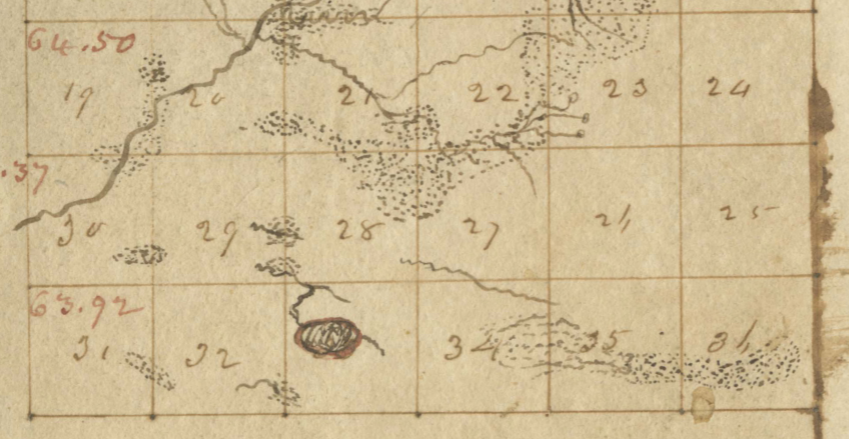
                                            Original land survey of south Almena Township.


McDermid Land Patent 1839


Thursday, October 29, 2020

MARTHA MOTT SANCTUARY - Overview

A former farmstead and woodlot in Almena Township, Van Buren County, this 80 acre sanctuary has a fine stand of oaks, hickory and walnut. There are open and shrubby fields and Hayden Creek along the south boundary. Typical southern Michigan birds such as Eastern Bluebirds, Field Sparrow and Red-eyed Vireos are found here.


View of Hayden Creek

That's the official Audubon version. Their sanctuary descriptions are very brief, provide no information about the property donor, and are out of date. I'll try to remedy that in the blog.

I've yet to see hickory trees; better look closer. The other day I discovered a Mountain Ash! One singular tree. Possibly a result of a tree is in the subdivision that parallels the east boundary and some hungry bird ate the berries then came here to poop. In Scotland it’s called a Rowan Tree with much folklore and myths.

The Mt. Ash is on the edge of a unique depression, small crater. There aren't any sizeable trees in it, but it has a row of Red Pine, the ubiquitous planation tree widely planted in the 1930's. So the depression may not be a natural feature. What did they dig out?

There is now a marked loop, with a well worn trail thru the grasslands. Yes the fields are getting shrubby with autumn olives but there is a nice stand of bluestem at the north end of the big field. And the goldenrod is lovely.

44th Ave at 24th St, Mattawan Almena Twp. T2S R13W Sec 36

 Parking Lot and Kiosk

Otis Sanctuary - Land Ownership Questions and Answers

Farm Silos - glazed & concrete block The original land patents for the acreage that became Otis farm was first sold in 1856, fairly late...